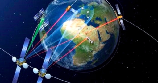
How Does Satellite Internet Work ?

Satellite Internet is the ability to transmit and receive data from a relatively small satellite dish on Earth and communicate with an orbiting geostationary satellite 22,300 miles above Earth's equator. The orbiting satellite transmits (and receives) its information to a location on Earth called the Network Operations Center or NOC (pronounced "knock"). The NOC itself is connected to the Internet (or private network), so all communication made from a satellite dish to the orbiting satellite will flow through the NOC before it reached the Internet.
This simple diagram above shows how data moves through a satellite network.
Data communication via satellite is not much different than someone using a land based data provider, at least from the standpoint of the Internet user. The key to remember is that once the satellite system is configured by the installer, satellite service acts nearly identically as any other ISPs and may be configured as such. The slight difference of satellite service is described here.
What is a Geostationary Satellite?
There is a location in space where you can place a satellite in orbit so that from the ground, the satellite appears stationary. What is happening is that the satellite is actually orbiting the Earth at the same speed the Earth is rotating. The satellite makes a complete orbit around the Earth in 24 hours, or exactly one day. Geostationary satellites are only located at 22,300 miles directly above the Earth's equator and nowhere else.
A Satellite's Longitude
All Geostationary satellites have a name like "Galaxy 18" or "AMC-4"... and they ALSO have a longitude position. If you recall from high school, longitude refers to those imaginary long lines that travel down the Earth for global mapping. There are 360 degrees of longitude readings for Earth (360 degrees is a full circle). If one knows the longitude of a satellite, one knows where the satellite is located in the sky because all Geostationary satellites are always located above the equator (or zero latitude).
To further confuse things, longitude is divided into two halves of West Hemisphere and East Hemisphere. All orbital "Slots" for satellites would be between 0° to 180° in the Eastern Hemisphere, and 0° to 180° in the Western Hemisphere. A satellite orbiting over the Galapagos Islands that services North and South America may have a Orbital slot of 101° West Longitude. A satellite orbiting over Malaysia that services Asia and Australia may have the orbital slot of 100.5° East Longitude. Satellite longitudes help installers locate where to point a satellite dish. It also helps in finding obstacles from an installation location and the satellite.
Make sense?
LIST OF ALL QUESTIONS ABOUT WIRELESS INTERNET